Chachapoyas and the Cloud Warriors

Chachapoyas liegt mitten in den Anden auf der Regenwaldseite. Mit ca. 2200m.ü.M war die Höhe kein Problem und wir freuten uns auf eine kleine Stadt, wie wir es uns in der Schweiz gewohnt sind. Diesmal buchten wir einen Bus mit den grossen Sitzen, allerdings war die Strasse so kurvig und holprig, dass wir trotzdem kaum ein Auge zugemacht haben.


Chachapoyas is located in the middle of the Andes on the rainforest side. At an altitude of 2200m above sea level we had no problem breathing and we were looking forward to a small town, as we are used to in Switzerland. This time we booked a bus with big seats, but the road was so curvy and bumpy that we still hardly closed an eye.

Kuelap - the city in the clouds

Am nächsten Tag gings auf unsere erste Tour. Im Bus trafen wir auf Maren aus Deutschland, mit der wir es so lustig hatten, dass wir gleich die nächsten Tage mit ihr verbrachten! 

Nach einer holprigen Fahrt und weiteren lustigen Fahrgästen, aufgebrezelte ältere Damen in Legins und Glitzer-Sneakers, kamen wir bei einer Seilbahn Station an, denn Kuelap liegt weit oben in den Bergen auf etwa 2900m. Da die Region sehr hügelig ist, kommt man so bedeutend leichter zur Stadt als früher. 

Von der Station gings nochmals mit einem anderen Bus weiter, zur effektiven Talstation (die Logik soll mal einer verstehen?!). Die Schotterstrasse war grob aus dem Felsen gehauen und dank lehmhaltigem Sediment entsprechend rutschig, der Bus hatte seine Mühe. Als wir dann vor uns einen anderen Bus etwas zur Seite gekippt in einem Schlammloch sahen, wurden die ersten Gesichter von gewissen Damen düster. Als der Bus nach 4 Anläufen die Kurve nicht überstand hiess es: Aussteigen und im Matsch laufen! Das Gefluche und Geheule der Glitzer-Sneaker-Fraktion war sehr unterhaltsam. 

Etwas schlammig gings mit der Seilbahn hoch. Oben angekommen erwartete uns eine atemberaubenden Aussicht mit immer wieder aufziehenden Wolken! Kein Wunder wurden die Menschen hier als Wolkenmenschen bezeichnet.


The next day we went on our first tour. On the bus we met Maren from Germany, with whom we had so much fun that we spent the next few days with her!

After a bumpy ride with other funny passengers, all dolled up slightly elderly ladies in leggings and glitter sneakers, we arrived at a cable car station. Kuelap is located high in the mountains at about 2900m. Since the region is very hilly, it is so much easier to get to the city by cable car than before.

From the station we went again with another bus, to the effective cable car station (that logic should one understand?!). The gravel road was roughly dug out of the mountainside, it looked like they were about to build a paved road. Since this area is mostly clayey sediment, the road was very slippery, especially after it had rained all night. The bus had a hard time getting up. When we saw another bus in front of us, a bit tilted to the side, in a mud hole, the faces of certain ladies fell apart. When the bus did not make the curve after 4 attempts, it was time to get out and walk in the mud! The cursing and howling of the glitter-sneaker faction was very entertaining.

Slightly muddy we entered the cable cars and went up. At the top, we were greeted by a breathtaking view with ever-gathering clouds! No wonder people here were called cloud people.

Kuelap wurde im Jahre 1843 von Don Juan Crisóstomo Nieto, einem Richter aus Chachapoyas, beim Wandern wiederentdeckt. Er kam spät Abends auf dem Berg an und legte sich schlafen nahe einer Felswand. Am Morgen wunderte er sich nicht schlecht als er vor einer 21m hohen Mauer stand, die er irrtümlich für einen Felsen hielt. 

Der Ruinenkomplex ist 580m lang und etwa 110m breit. Der Eintritt ist nur über einen der drei hohen, aber extrem schmalen, Eingänge möglich. Der auf den meisten Fotos abgebildete Haupteingang war leider gerade in der Restaurierung (seit 2 Jahren).

Die Stadt beherbergte über 300 einzelne typisch runde Häuser auf drei Ebenen mit verschiedenen Gesellschaftsklassen, was man an der Verzierung der Häuser erkennen kann. 

Wasser gabs keines. Das Wasser wurde von einem 50km entfernten See nach Kuelap gebracht. Teilweise wurde auch Regenwasser gesammelt. Die Inkas hatten es entsprechend leicht die Stadt einzunehmen, sie mussten nur die Wasserzufuhr kappen. 


Kuelap was rediscovered in 1843 by Don Juan Crisóstomo Nieto, a judge from Chachapoyas, while hiking. He arrived late in the evening on the mountain and laid down to sleep near a huge rock. In the morning, he was surprised when he stood in front of a 21m high wall, which he mistakenly thought was a rock. 

The ruin complex is 580m long and about 110m wide. Admission is only possible via one of the three high, but extremely narrow, entrances. The main entrance depicted in most of the photos was unfortunately in the restoration (for 2 years). 

The city housed over 300 individual typical round houses on three levels with different classes of society, which can be seen in the decoration of the houses. 

The city was built high up. They got water from a lake that's 50km away or from nearby rivers. Later when the city was too big they also started to collect the rain. The Incas had an easy way of conquering because they just cut their resources like water. 

Beautiful women and the sharpest knife on earth

Chachapoya heisst soviel wie Wolkenberge in Runa Simi der Sprache der Inkas (Quechua ist die Bezeichnung der Volksgruppe und nicht die Sprache und Inka heisst soviel wie “König”, der Einfachheit halber schreiben wir aber weiter von den Inkas.) 

Die Kultur war sehr interessant für die Inkas, da sie ein tiefes medicinal Wissen hatten und schöne Frauen. 

Sie benutzen Obsidian Messer aus vulkanischem Glasgestein als Skalpell für Operationen. Archäologen fanden viele Schädel mit Löcher die Heilungsverläufe aufzeigen. Es handelte sich meist um Krieger die einen harten Schlag auf den Kopf erhalten haben. Um den Druck des sich anschwellenden Hirns zu lösen führten die Schamanen diese Operation durch. Die Überlebensrate war super hoch. Obsidian ist sogar schärfer als heutige Skalpelle, hat sich jedoch in Studien nicht durchgesetzt. 

Und was war das mit den Frauen? Chachapoya sind grösser als der Durchschnitt, wie die Inkas. Aber das alleine war wohl nicht der Grund, ich denke es war wohl eher; das Grass im Garten des Nachbarn ist grüner ;) 

Die Chachapoya mochten die neue Inka Herrschaft überhaupt nicht. Weshalb sie sich mit den Spaniern verbündeten. Das war allerdings ihr Todesurteil. Kaum waren die Inkas weg löschten die Spanier systematisch die Menschen und ihr kulturelles Wissen aus. Heute weiss man sehr wenig über die Kultur und da Kuelap nicht so berühmt wie Machu Picchu ist fehlt das Geld für Forschungen. 


Chachapoya comes from the inca meaning «cloudy mountains». Those people were especially interesting for the incas to conquer because of their medicinal knowledge and beautiful women. 

They used obsidian knives (volcanic glass) as scalpels for operations. Archaeologists found many skulls with holes in their head with signs of healing. They were mostly warriors which got hit on the head by weapons. To release the pain of the swollen brain the shaman would cut open the heads to release the pressure. Since obsidian is much sharper than scalpels, they tried to use them instead. However studies did not show that much of a difference so the idea was discarded. 

As for the women, the Chachapoya people were taller than most of the other cultures. Since the Incas were as well: good match! But I don't think that was the mane reason, I think the grass is always greener on the other side of the fence. ;) 

The Chachapoya did not like being conquered though. This is why they sided with the Spanish to get rid of their oppressor (which the incas not really were but that's another issue). Sadly this was their downfall because after the incas were gone the Spanish eradicated them. Nowadays there is very little known and since Kuelap is not as popular as Machu Picchu the money to get to know more is scars.


Von Stalaktiten, Mumien und falschen Versprechungen.

Am nächsten Tag war schon die nächste Tour angesagt, diesmal gings lange mit dem Combi-Bus in die Berge. Als erstes war eine Höhlenbesichtigung auf dem Programm, wir hatten nicht viel erwartet doch was wir drinnen vorfanden war echt beeindruckend. 

Riesige Stalagmiten und -titen waren in noch grösseren Gewölben zu erkennen! Die Höhle selbst war sehr schlammig und feucht, weshalb es nur Handy Fotos gibt und die sind entsprechend qualitativ beschränkt ;)


On the next day another tour was calling. This time we drove with the Combi-Van deep into the mountains. The first tour was a Cave of witch we did not expect much but what we saw inside was amazing!!!

Huge stalagmites and stalactites were visible in even larger vaults! The cave itself was very muddy and humid, which is why there are only cell phone photos and they are obviously lacking in quality ;)


The Sarcophagus

Weiter gings zu den Sarkophagen und Mumien. Dani war schon ganz hibbelig. Waren doch auf dem Flyer riesige Sarkophage abgebildet, es war sogar die Rede von Mumien in den Sarkophagen. Die Fahrt ging eine gefühlte Ewigkeit auf löchrigen Schotterstrassen die Berge hoch. 

In einem Dorf angekommen, krakselten wir einen steinigen, rutschigen Weg nach unten und dann…. war da eine riesige Felswand…?! Beim näheren Hinschauen konnten wir in der Höhe weit oben die Sarkophage erkennen. Doch der Pfad ging noch weiter, vielleicht gibt es ja noch einen Hintereingang?


Next we went to the sarcophagi and mummies. Dani was already very excited. There were huge sarcophagi on the flyer, there were even mummies mentioned. The ride felt like an eternity on holey gravel roads up in to the mountains.

Finally we arrived in a village, we hiked a rocky, slippery path down and then .... there was a huge cliff in front of us... ?! On closer inspection, we could see the sarcophagi high up in the wall. But the path went further, maybe there is still a back door to see them better?

Auf dem Weg unterhalb der Felswand fanden wir viele violette Steine die auch heute noch zum färben benutzt werden. Einige Knochen, auch welche von Menschen, waren teilweise auf dem Weg zu finden. Unter einem Wasserfall durch auf der anderen Seite angekommen konnten wir noch weitere Sarkophage im Fels erkennen. Und das wars… Keine Mumien oder Sarkophage aus der Nähe. 

Unser Guide erklärte uns, dass bis heute ungeklärt ist, wie die Sarkophage dort oben platziert wurden. Bei den Mumien handelt sich vermutlich um wichtige Krieger. Hinter den Sarkophagen wurden auch noch Knochen (besonders Köpfe) gefunden, vermutlich die ihrer Feinde. Äusserst spannend jedoch ist die Tatsache, dass sämtliche Gräber in dieser Region immer auf etwa der gleichen Höhe liegen, nämlich auf 2800m. Wie das die damaligen Leute hingekriegt haben, ist schleierhaft. 


On the way below the rock face we found many violet stones that are still used for coloring today. Some bones, some of them human, were partially on the way. Under a waterfall on the other side we could see more sarcophagi in the rock. And that was it ... No mummies or sarcophagi up close.

Our guide explained to us that it is still unclear how the sarcophagi were placed up there. The mummies are probably important warriors. Bones (especially heads) were also found behind the sarcophagi, presumably those of their enemies. Extremely exciting, however, is the fact that all graves in this region are always at about the same height, namely at 2800m. How the people of the time got it is a mystery.

Pausentag & Huanca Viewpoint 

Infos für unsere Touren holten wir immer bei iPeru, das ist eine öffentliche Touristeninformationsstelle, welche es an den meisten (touristischen) Orten in Peru gibt. Hier wurde uns gesagt wie viel man für geführte Touren zahlt und auch wie man es auch auf eigene Faust machen könnte inkl. den Kosten. 

Wir entschlossen uns deshalb den Gocta Wasserfall und den Huanca Aussichtspunkt alleine bzw. mit Maren zu machen. 

Als öffentliche Busse fungieren Combis (Kombi-Vans), grosse Busse sind fast ausschliesslich für lange Strecken im Einsatz. Hinter der windschutzscheibe steht meist wohin der Combi fährt und nervig-motivierte Begleitfahrer versuchen, einen von der Qualität der meist lottrigen Combis zu überzeugen. So war es zumindest in Chiclayo. 

In Chachapoyas mussten wir diese zuerst einmal finden. Maren war schon früher dort (und wir wieder mal zu spät!) und führte uns zu einem Combi. Da es zuwenig Platz hatte, warf der Fahrer kurzerhand die alte Frau auf der Rückbank raus und gab ihr ein Holzschemeli zum Sitzen neben der Türe!!! Hallo?! Das Argumentieren nützte nix, so fuhr der Combi eine holprige Strasse hoch zum Aussichtspunkt. Das Auto war gerade noch fahrtüchtig und unsere Sitze hielten gefühlt an einem seidenen Faden. 

Oben angekommen war die Aussicht unglaublich! Man sieht fast das ganze Tal mit einer Länge von 12km. Bis zum Fluss sind es etwa 612m. Wir wanderten etwas an der Krete entlang und handelten uns unseren ersten Sonnenbrand ein, trotz Sonnenschutz… Damn!


We always got our information for our tours from iPeru, which is a public tourist information center, located in most (tourist) places in Peru. Here we were told how much you pay for guided tours and how you could do it on your own including the costs.

We decided to do the Gocta waterfall and the Huanca viewpoint alone with Maren.

To do this we had to go by Combis (combi vans). They function as public buses, while large buses are almost exclusively used for long journeys. Behind the windshield is usually where the Combi drives and annoying-motivated companion drivers try to convince you of the quality of the shitty Combis. Or so it was at least in Chiclayo.

In Chachapoyas we first had to find the Combi Place. Maren was there before us (and we too late again!) and led us to a Combi. Since there was not enough space, the driver unceremoniously threw the old woman in the back seat out and gave her a small wooden chair to sit next to the door! Excuse me?! Arguing was of no use, so the Combi drove a bumpy road up to the viewpoint. The car was barely roadworthy and our seats felt like they were holding on to a thin thread.

At the top, the view was amazing! You can almost see the whole valley with a length of 12km. The river is about 612m deep down. We walked a bit along the crete and got our first sunburn, despite sunscreen ... Damn!

The Gocta Waterfall Odyssey

Es gibt einen riesigen Wasserfall in der Nähe von Chachapoyas. Der Legende nach lebt dort eine hübsche Sirene, die allen Männern den Kopf verdreht. Diese verschwinden danach spurlos, weshalb der Wasserfall für die lokale Bevölkerung nicht wirklich spannend war und sie es angeblich geheim halten wollten. Ein Deutscher war jedoch auf der Suche nach hohen Wasserfällen und entdeckte Gocta 2002, den er dann vermass und siehe da: der Wasserfall ist mit 771m einer der höchsten weltweit! Er ist in zwei Teile geteilt: der obere Teil misst 230m und der untere 541m.

Es gibt mehrere Routen für die Wanderung, wir entschieden uns den gesamten Rundkurs zu machen: vom oberen Dorf San Pedro zum oberen Teil de Wasserfalls, dann runter zum Boden und zurück zum unteren Dorf Cocachimba. iPeru erklärte uns, dass die Wanderung etwa 8h dauert und moderat sei, sie zeigten uns sogar ein Video dazu. Sah wirklich easy aus… 

War es aber nicht! Der erste Teil war ganz OK, es ging immer wieder bergauf, und runter auf nassen Steinen und teils schlammigen Wegen. Urwald halt. Immer wieder regnete es ein bisschen. Nach ca. 2h hatten wir den oberen Wasserfall erreicht, amazing!!!! Schon beim Anschauen wurde man pitschnass vom Sprühregen :D


So there's this huge waterfall near Chachapoyas. According to the legend there lives a beautiful maiden (an evil spirit) that charmes all the single men that approach her. After that they vanish, this is why the Waterfall did not hold much interest for the locals and it's said that they tried to keep it a secret. But a German guy was searching for big waterfalls and found Gocta in 2002, after measuring it he realised it was huge! 230m on the top, 541m on the bottom, in total 771m.

There are several routes for the hike, so we decided to do the whole circuit: from the upper village of San Pedro to the upper part of the waterfall, then down to the bottom and back to the lower village of Cocachimba. iPeru told us that the hike takes about 8 hours and is moderate, they even showed us a video. Looked really easy... 

It was not! The first part was OK, it was always uphill, and down on wet stones and partly muddy paths, the Jungle as you know it. From time to time it rained a bit. After about 2 hours we reached the upper waterfall, amazing !!!! Even when looking at it from afar you became dripping wet from the drizzle :D

Nach einem kurzen Snack folgte der Abstieg zum Becken des Wasserfalls (und ihr wisst ja jetzt wie hoch der ist). Dieser Teil stellte sich als Tortur heraus, denn er führte entlang einer Felswand mit viel schlamm, nassen Steinen und Vegetation wie z.B. Bäumen, die mal einfach im Weg wuchsen. So rutschten, kletterten und stolperten wir den Pfad runter. Nach einer gefühlten Ewigkeit kamen wir bei einer Brücke und später bei einer Weggabelung an. Da Dani mit den Kräften am Ende war, entschieden wir uns aufzuteilen. Rado geht zum Becken mit Maren und Dani langsam Richtung Ziel. 

Der Weg zur Stadt war einfach: Hügel hoch, Hügel runter, über eine Brücke, Hügel hoch, Hügel runter etc. Nach dem dritten Hügel drehte Dani langsam durch. Konnten die keinen Weg direkt am Fluss bauen?! Dann müsste man nicht jedesmal hoch und runter! In der Hälfte kam ihr ein älterer Herr entgegen, der mit seinen Sandalen locker flockig den Hügel runter düste. Plötzlich wurde uns klar: verdammt, die Peruaner waren ja super im Wandern vermutlich ging das ganze länger als 8h und moderat ist wohl eher anspruchsvoll!!!

Kurz nachgefragt wie weit es noch zum Dorf ist, lachte er nur und meinte: total nah, etwa 20min. 1.5h später kam Dani erschöpft im Dorf an und legte sich auf die Wiese auf dem Dorfplatz und wartete. 

Rado war in der Zwischenzeit zum Wasserfallbecken gespeeded. Wo er auf Maren traf, die schon vorgegangen war. Das Becken selbst ist riiiesig, könnt ihr auf dem Foto den Menschen in Badehosen sehen? Durch die enorme Wassermasse entstehen starke Winde mit Sprühregen und selbst wenn man etwas weiter weg steht, wird man innert Sekunden pitschnass. Rado brauchte definitiv keine Dusche mehr! 

Danach gings zügig zurück, auf dem Weg wurde noch ein Snack gekauft und der hungrigen Dani am Dorfplatz überreicht. 


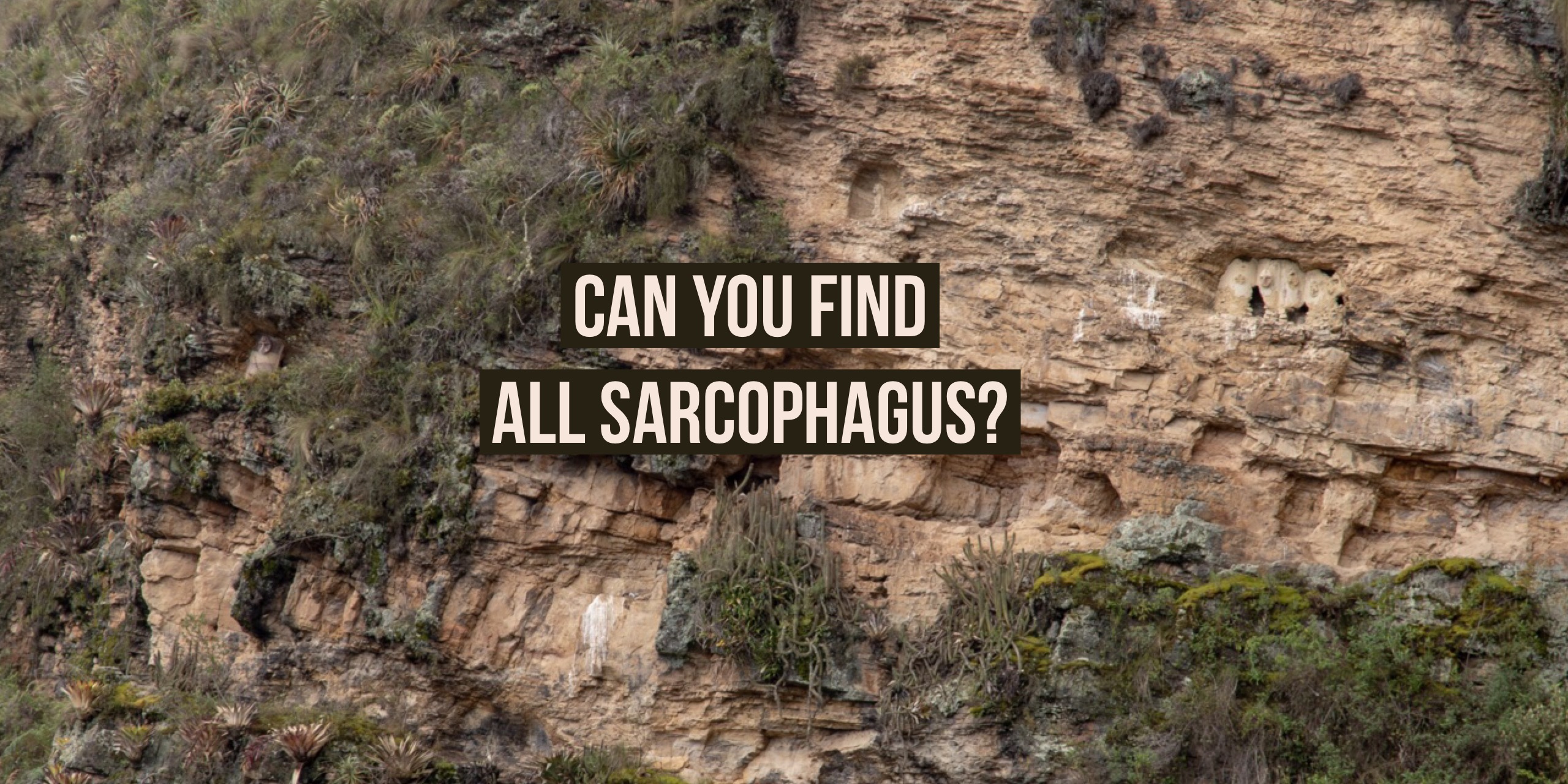
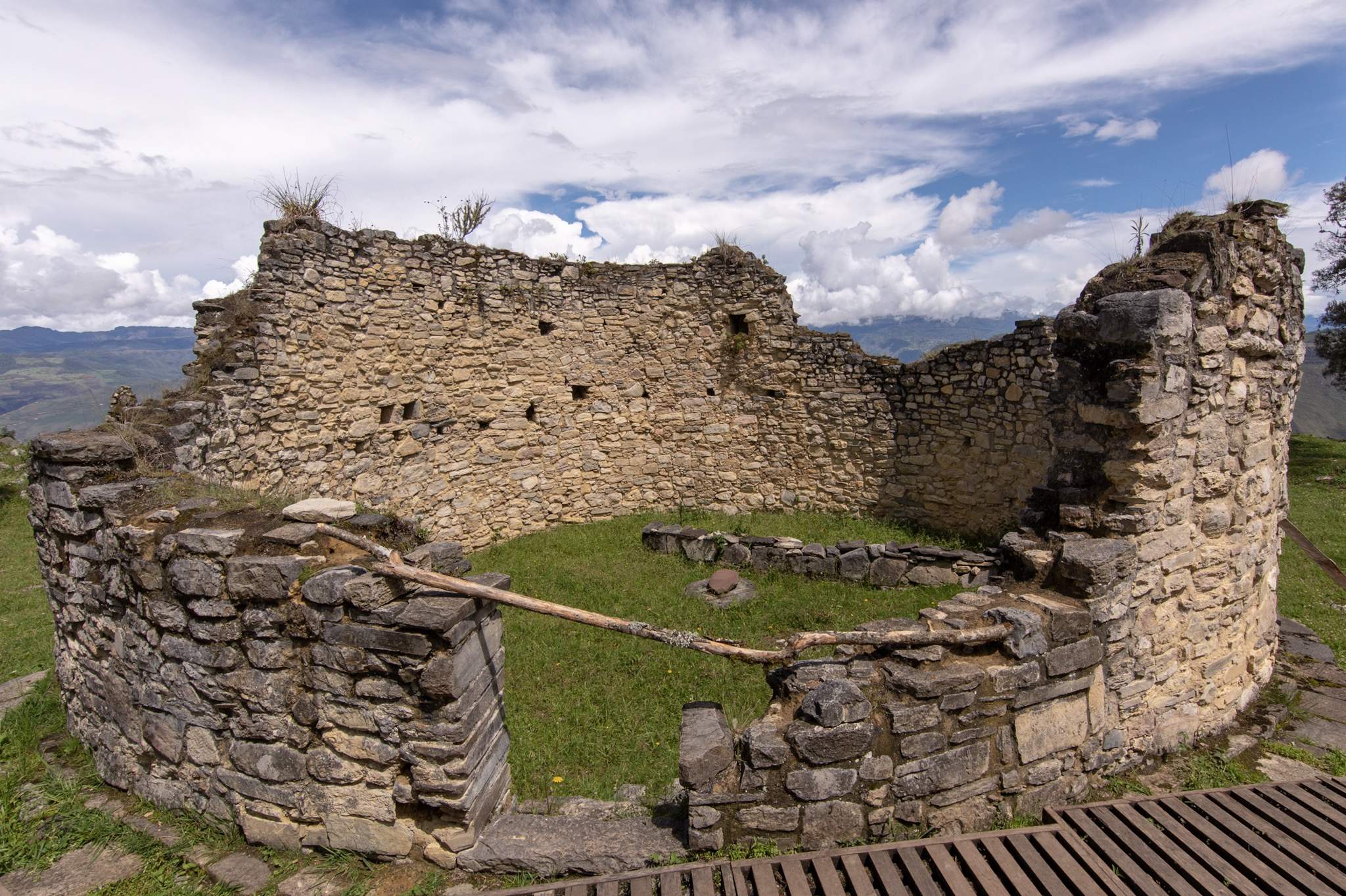
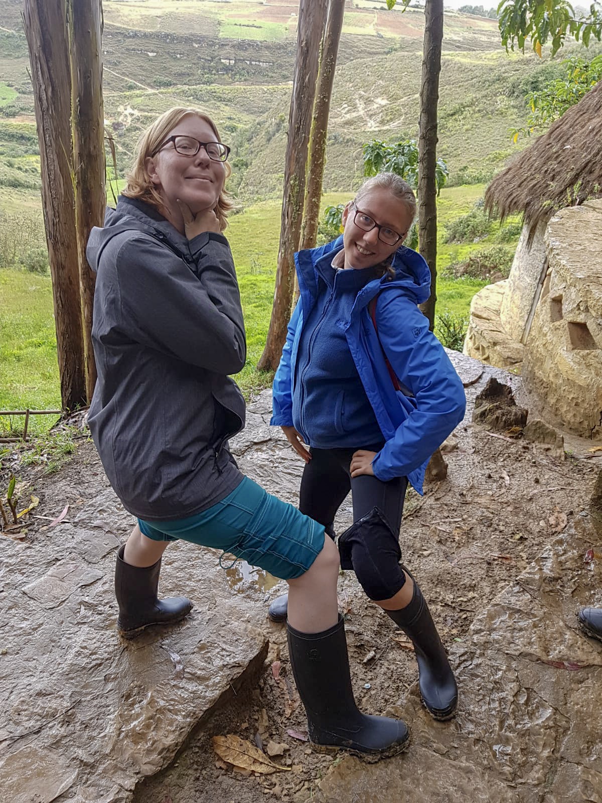
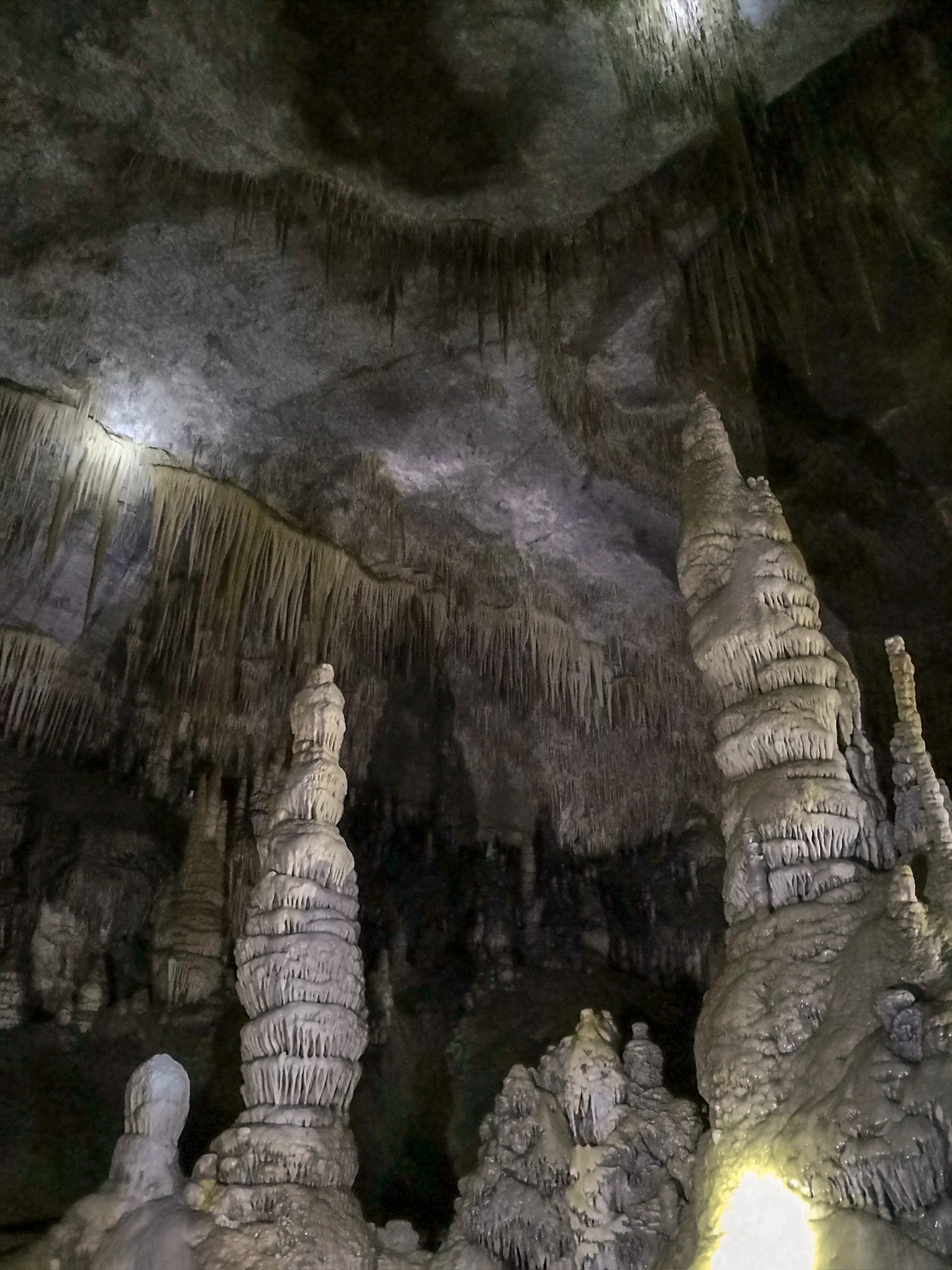
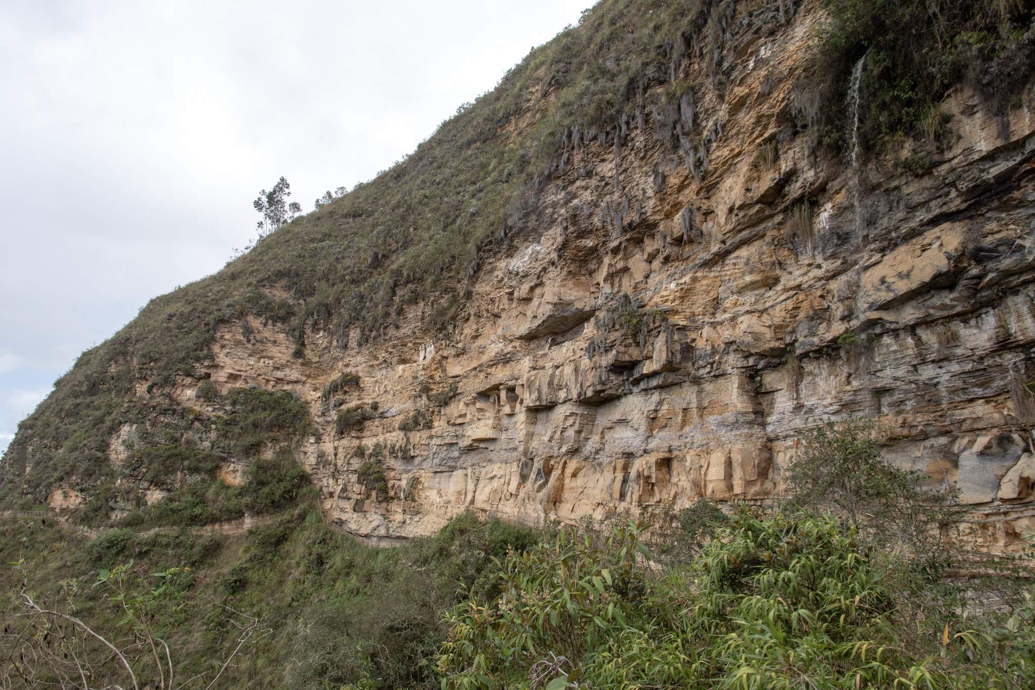
After a short snack, the descent to the basin of the waterfall followed (and you know now how high that is). This part turned out to be torture, because it led along a rock face with a lot of muddy, wet stones and vegetation. Like trees that just grew in the way. So we slipped, climbed and stumbled down the path. After a felt eternity, we arrived at a bridge and later at a fork in the road. Since Dani was exhausted, we decided to split up. Rado went to the pool with Maren and Dani slowly towards the finish.

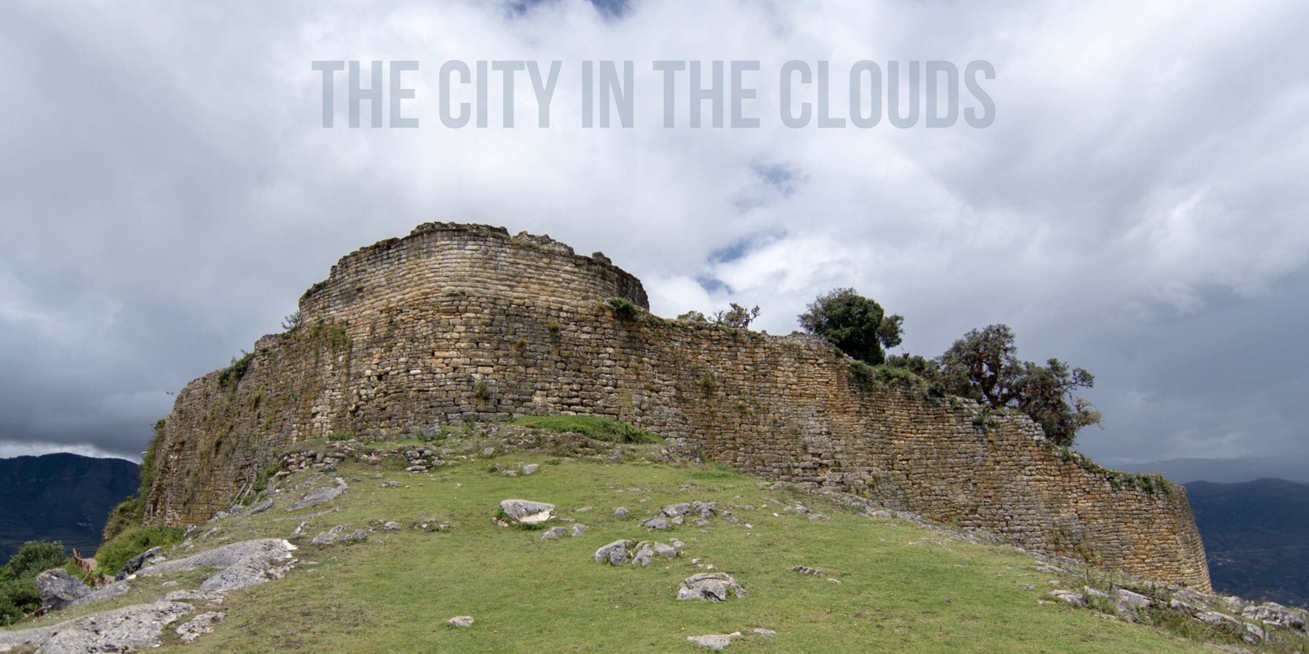
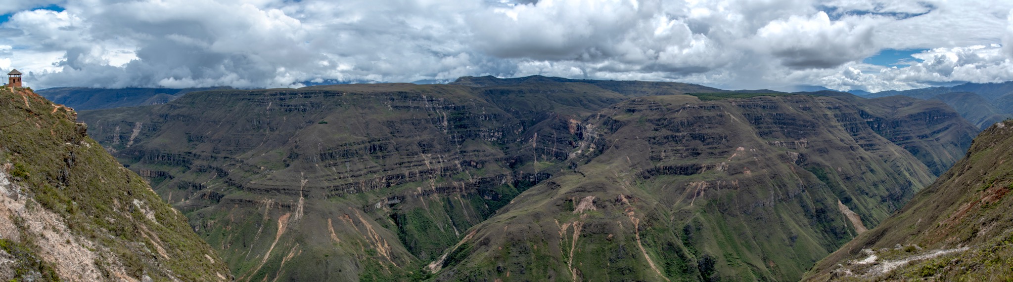
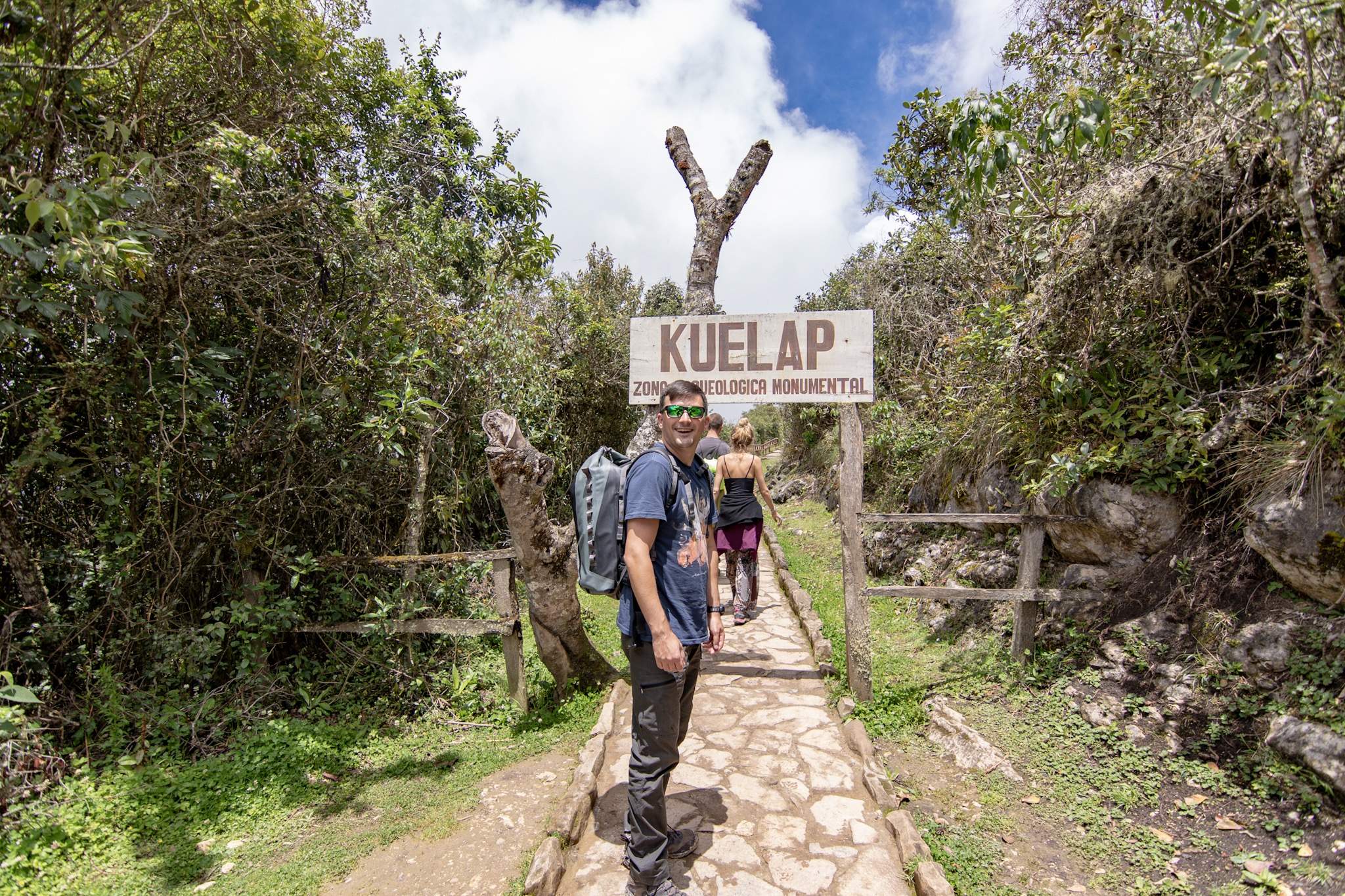
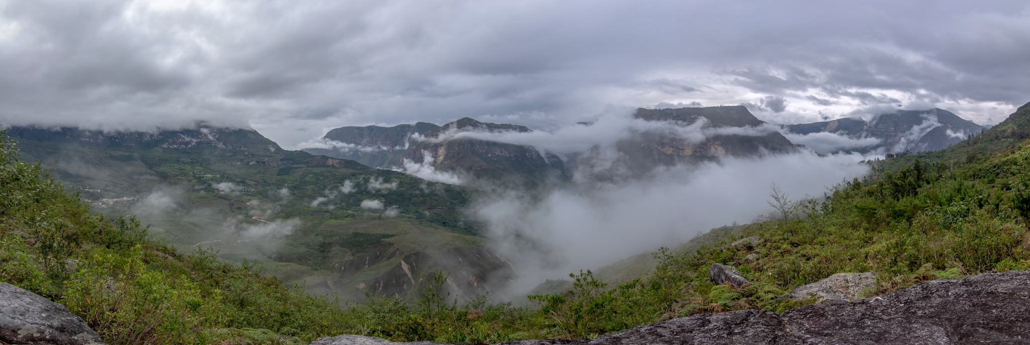
The way to the city was easy: up hill, down hill, across a bridge, up hill, down hill, etc. After the third hill, Dani slowly turned mad. Could they not build a way directly on the river?! It felt like a waist of energy walking up and down all the time! In the middle, an elderly gentleman came along the road and greeted her (he just easily speeded down the hill with his sandals!!!). Suddenly we realized: damn, the Peruvians were great in hiking probably the whole tour was longer than 8h and moderate is probably more demanding !!!

Dani asked how far it was to the village, he laughed and said: totally close, about 20min. 1.5 hours later, Dani arrived exhausted in the village and layed down on the grass in the village square and waited.

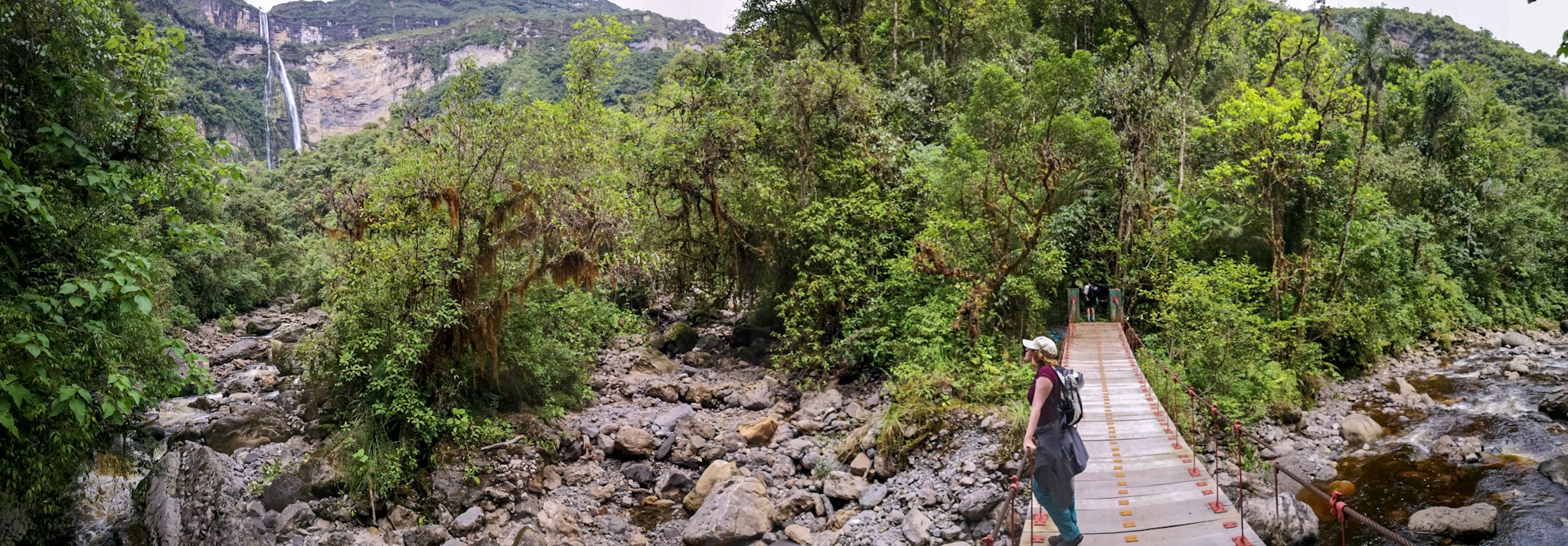
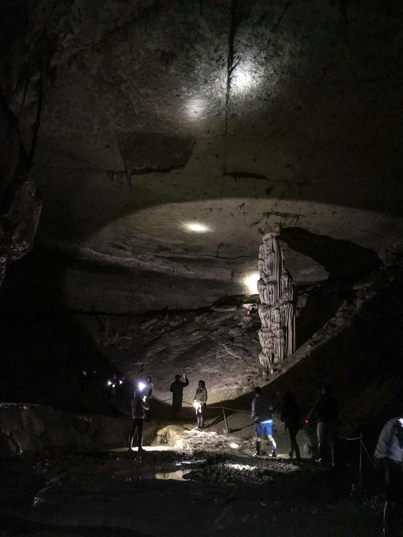
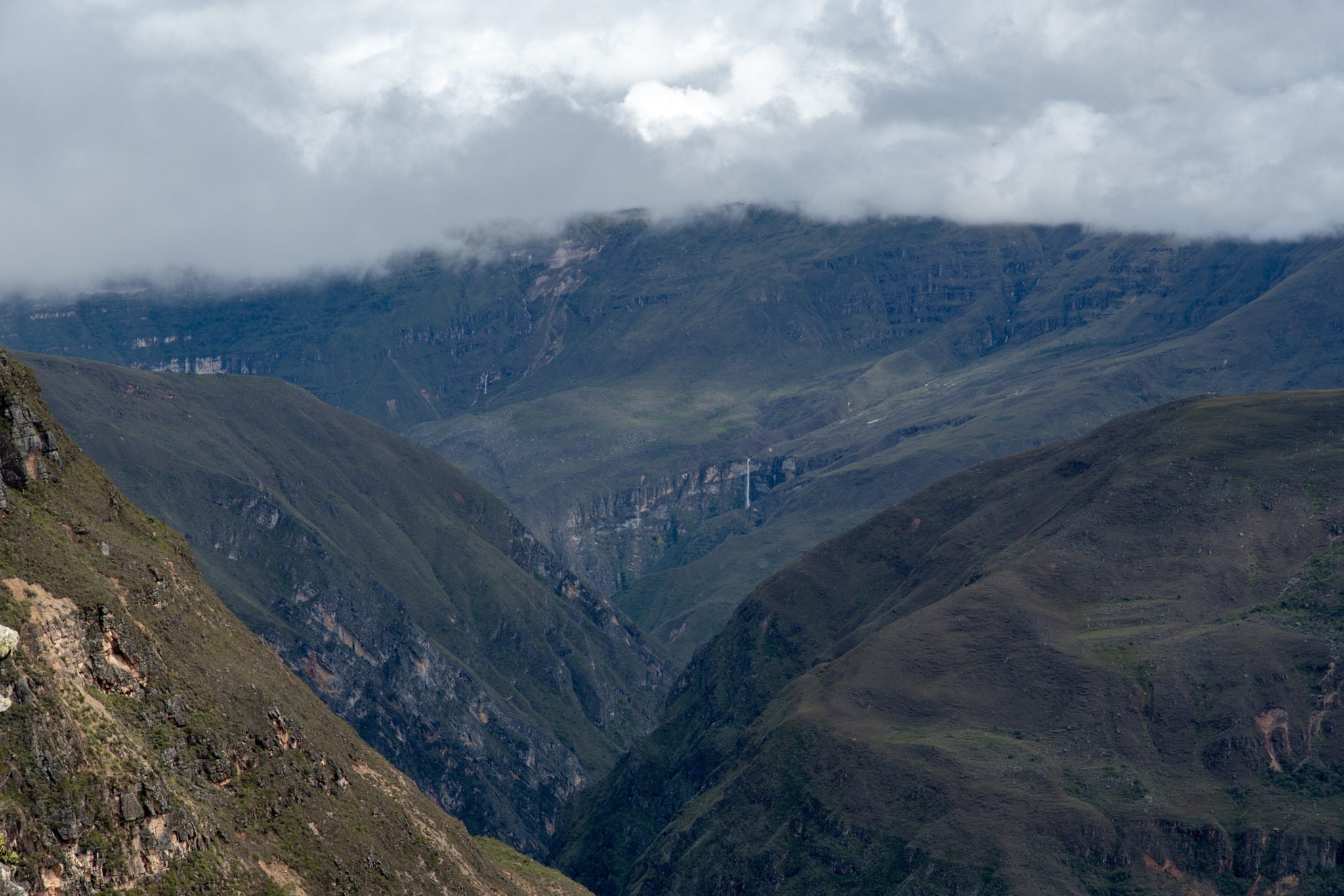
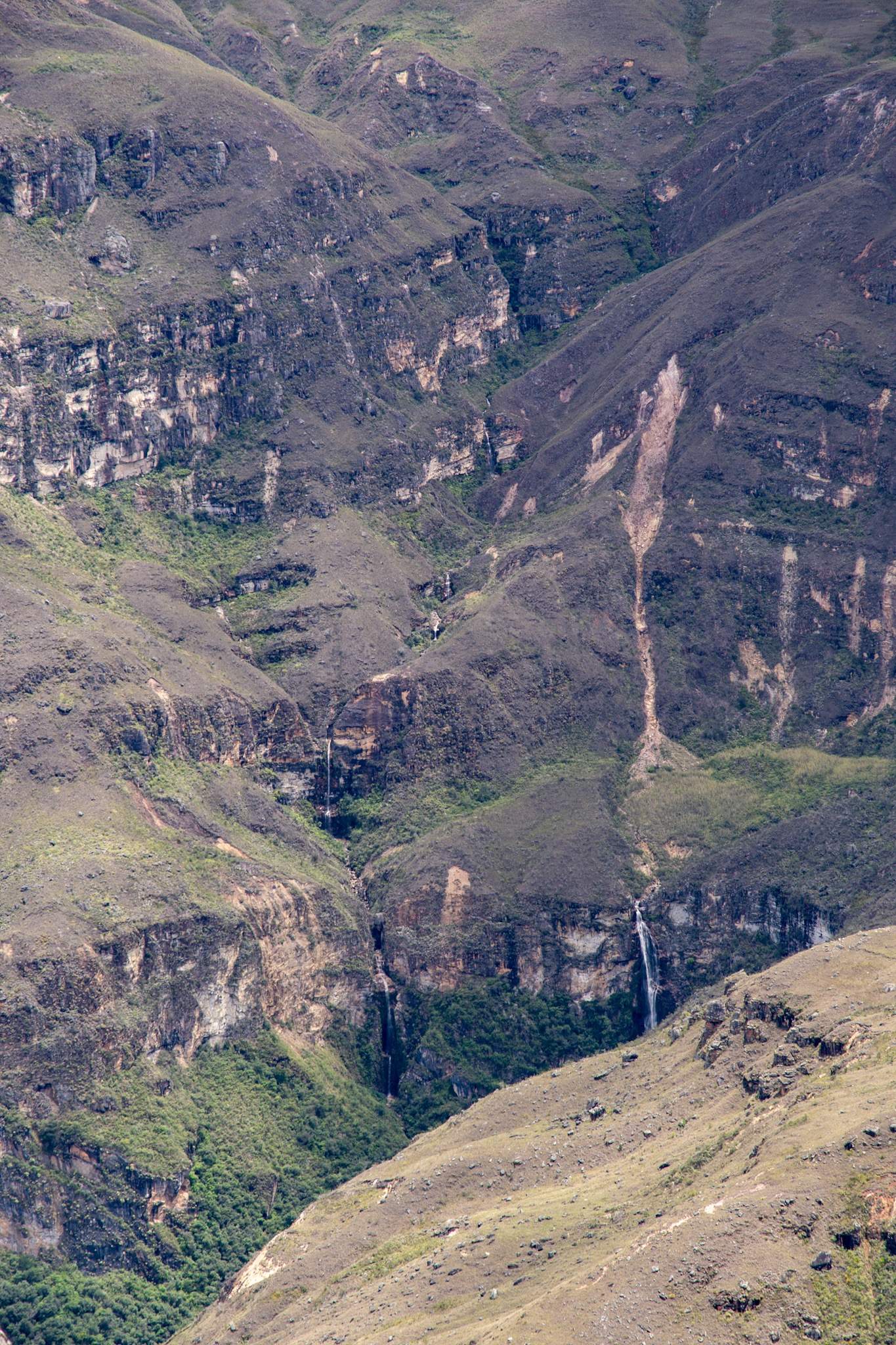
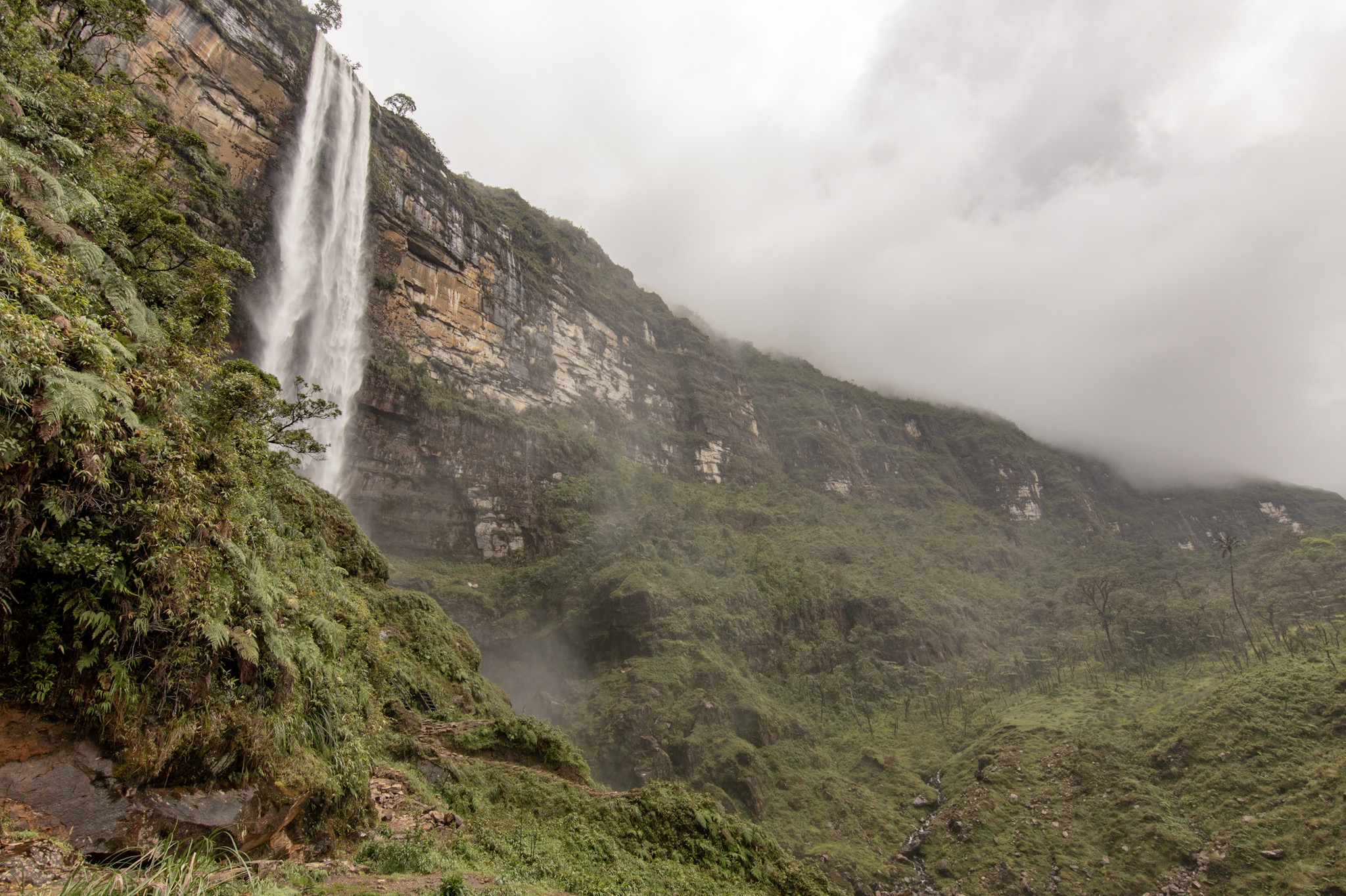
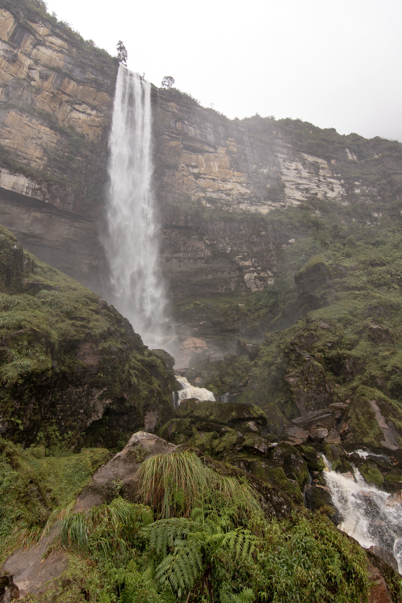
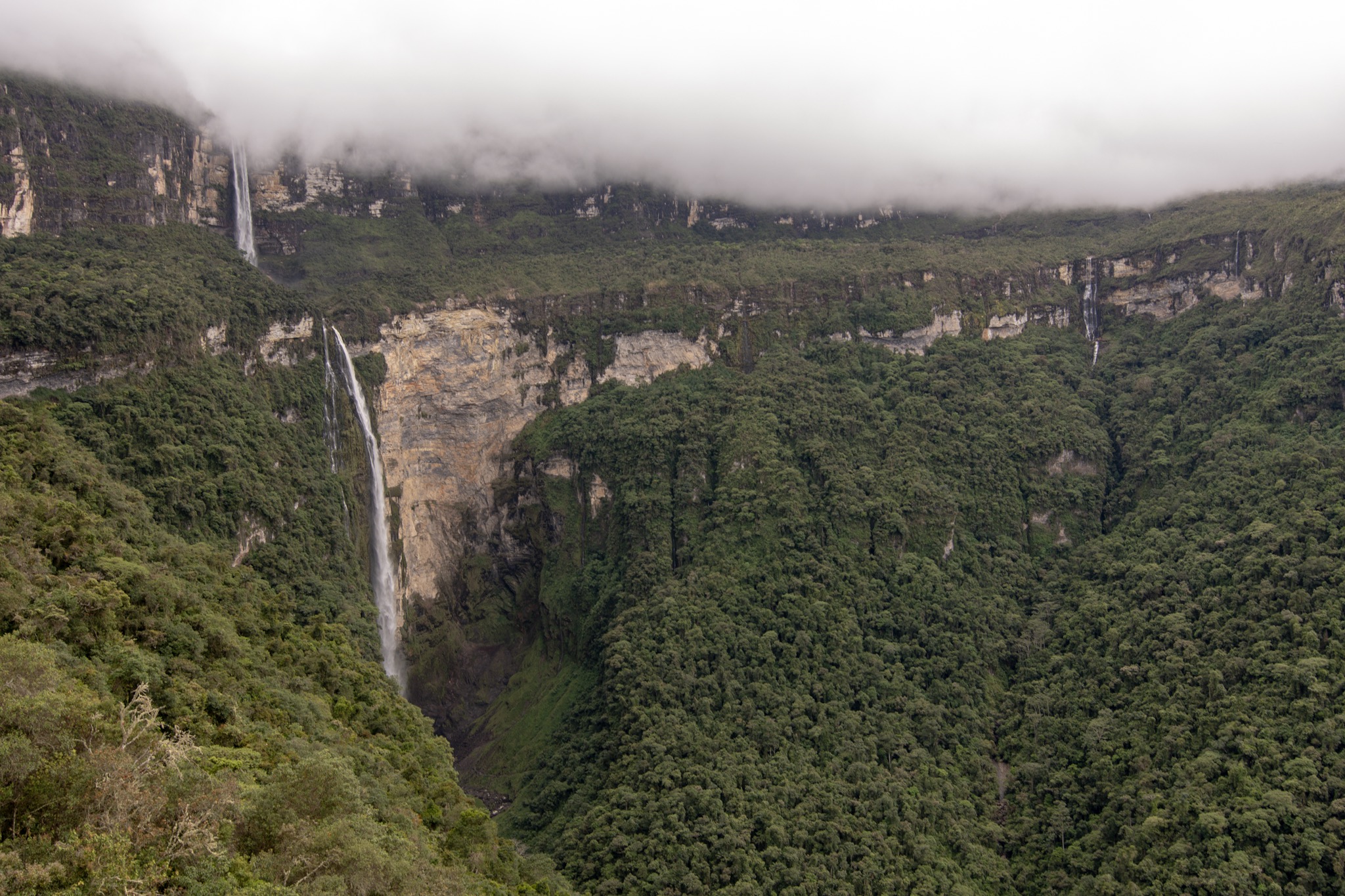
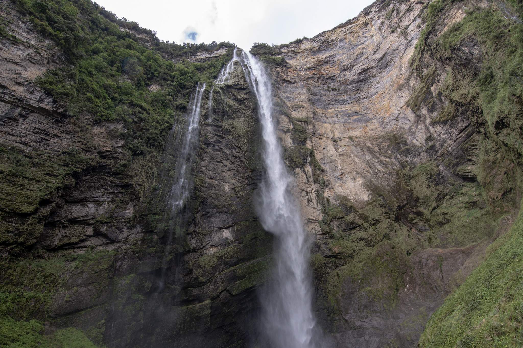
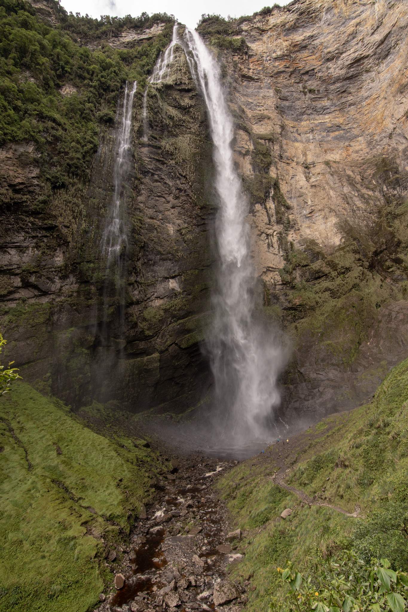
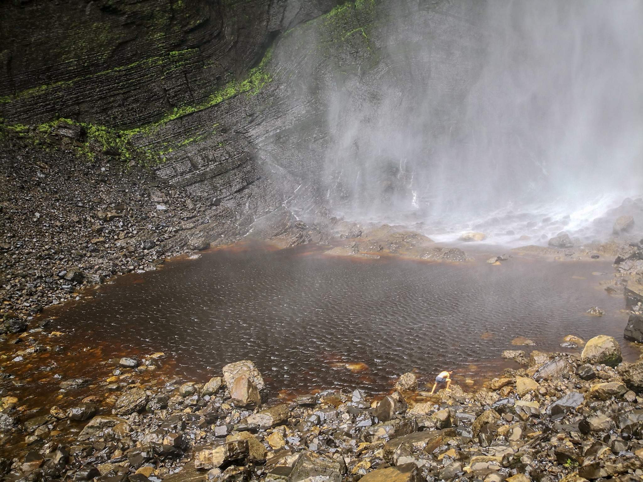
Rado in the meantime was heading to the waterfall basin. The basin itself is huuuuge, can you see the tiny human in the photo? The enormous mass of water creates strong winds with drizzle and even if you are far away, you will be soaking wet within seconds. Rado definitely did not need a shower anymore!

Maren and Rado went back quickly, on the way they bought a snack which was presented to the hungry Dani at the village square.

Zurück gings mit lustigen Mototaxis zum Combi Pick-up Point. Eine Frau funkte den fahrenden Combi an, ob er noch Platz hatte. So quetschen wir uns in den vollen Combi und gingen danach in unser Lieblingsrestaurant in Chachapoya essen dem El Batan Del Tayta. 

Maren und Dani waren so hungrig, dass sie sich gleich noch eine zweite Portion des Menüs teilten. 

So mussten wir leider von Maren Abschied nehmen, denn am nächsten Tag war unser Flug nach Lima. 

Wir hatten eine tolle Zeit in Chachapoyas, man konnte überall hin laufen und unsere Airbnb Hosts Aline und Pedro waren super nett. Die Wohnung war fantastisch, ein super bequemes Bett und blitzsauber. 


We went back with funny mototaxis to the Combi Pick-up Point. A woman radioed the driving Combi, if he still had room. So we squeeze into the full combi and then went to our favorite restaurant in Chachapoya to eat: El Batan Del Tayta.

Maren and Dani were so hungry that they shared another of the same portion of the menu.

Unfortunately this is were we had to say goodbye to Maren, because the next day was our flight to Lima.

We had a great time in Chachapoyas, you could walk everywhere and our Airbnb hosts Aline and Pedro were super nice. The apartment was fantastic, a super comfy bed and spotlessly clean.